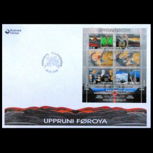
Faroe Islands 2009
"The origin of the Faroe Islands"
| Issue Date |
25.05.2009 |
| ID |
Michel: 669-674, Bl. 25 ;
Scott: 513a-f, 513 ;
Stanley Gibbons: MS596 ;
Yvert et Tellier: 665-670 ;
Category: Ot |
| Design |
Anker Eli Petersen |
| Stamps in set |
6 |
| Value |
DKK 10 - Origin of the Faroe Islands The Lower
Basalt Formation
DKK 10 - Volcanic Ash
DKK 10 - Continental Drift 60 MY ago
DKK 10 - Continental Drift 15 MY ago
DKK 10 - Intrusions
DKK 10 - Depressions, Ice Ages and Erosion
|
| Emission/Type |
commemorative |
| Issue place |
Torshavn |
| Size (width x height) |
stamps: 26 mm x 40 mm,
Mini-Sheet: 110 mm x 94 mm
|
| Layout |
Mini-Sheet of 6 stamps and 4 tabs |
| Products |
FDC x1 |
| Paper |
|
| Perforation |
12.5 x 13 |
| Print Technique |
Offset lithography, full color |
| Printed by |
The Lowe-Martin Group, Canada |
| Quantity |
|
| Issuing Authority |
Posta Faroe Islands |
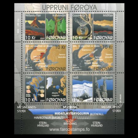
On May 25 2009, the Post Authority of Faroe islands issued the Mini-Sheet
with 6 stamps "The origin of the Faroe Islands", that shows the prehistoric
continent Pangea and continental drift.
DKK 10 rate, at the date of issue, was corresponding to postage rate of
large inland letter or small letter to Europe with weight up to 50 gr.
The following text is based on text written by Anker Eli Petersen and was edited
by geologists from Jarfeingi (The Faroese Geological Survey).
Petersen's text was published on the
Faroe Post website in 2009.
Some small changes were made to the text by this website's authors to provide clarity.
Continental Drift
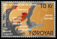
Millions of years ago the continents of the Earth were joined in a super
continent called Pangaea.
 |
|
Pangea continent on stamp of Faroe island 2009
MiNr.: 671, Scott: 513c.
|
 |
|
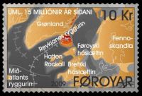
Pangea continent on stamp of Faroe island 2009
MiNr.: 672, Scott: 513d.
|
About 200-135 million years ago, Pangaea split into two parts, Laurasia
in the north and Gondwana in the south.
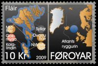
About 60 million years ago the seafloor had started to spread between
Canada and Greenland along the Labrador Ridge, and between Greenland
and the Faroe-Rockall plateau along the Mid Atlantic Ridge.
This was the start of an era of intense volcanic activity along the entire
continental shelf, and volcanoes appeared all the way from Greenland,
on the Faroe-Rockall Plateau and along the west coast of Scotland down
to the south eastern corner of Ireland.
Great parts of the Faroe-Rockall Plateau as well as parts of the British Plateau
sank below sea level.
During this rifting, the Atlantic Ocean was initiated and started to grow into
the modern ocean basin separating North America and Eurasia.
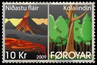
Origin of the Faroe Islands - The Lower Basalt Formation
 |
|
Origin of the Faroe Islands The Lower Basalt Formation on stamp 2009
MiNr.: 669, Scott: 513a.
|
On the Faroe Plateau there were intense eruptions from gigantic
volcanic fissures with shorter or longer breaks. The lava settled in
layers and became the Lower Basalt Formation. These layers are thick,
the average height is about 20 metres and the total height of the Lower
Basalt Formation is about 900 metres.
The Coal Bearing Formation
When the volcanoes, which created the Lower Basalt Formation, stopped,
there was a long period without volcanic activity. The top of the
formation crumbled and eroded in the subtropical climate, vegetation
started to spread and eventually turned into regular forests. The coal
bearing formation with charred tree trunks, roots, leaves and other
organic remains, and the thin sedimentary layers show that the break in
the volcanic activity lasted for a long time.
 |
|
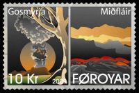
Volcanic Ash on stamp of the Faroe Islands 2009
MiNr.: 670, Scott: 513d.
|
Volcanic Ash
The long period of growth, which created the coal bearing formation,
came to an abrupt end in an explosive pyroclastic eruption. Lava bombs,
volcanic tuff and ashes spread over the landscape and charred and
covered the forest. There was very little lava in this first explosion,
and a thick and irregular layer of reddish tuff covers the coal bearing
formation.
The Middle Basalt Formation
As a direct continuation of the pyroclastic eruption, a period of
constant volcanic activity started.
There were only very short or no breaks between the lava flows in this period.
These eruptions created the middle basalt formation, with layers much thinner
than the lower
and upper formations. Most layers are thinner than 1-2 metres. Put
together, these layers form the thickest formation, appr. 1350 metres.
The Upper Basalt Formation
Again there was a break or at least a change in the volcanic activity.
When the volcanoes became active again, the eruptions were not as
frequent as when the middle basalt formation was formed, but with
shorter or longer breaks in between. The lava flows from this period
became the upper basalt formation with layers average about 10 meters thick.
The upper basalt formation is appr. 675 metres in total.
 |
|
Intrusions on stamp of the Faroe Islands 2009
MiNr.: 673, Scott: 513e.
|
Intrusions
At the base of the massive plateau, stresses caused the rock to break up and fracture.
These fractures or cracks allowed magmas to rise along these conduits - but during
this time, the magmas did not go all the way to the surface.
Instead these magmas cooled and crystallized in the fractures to form a variety of
igneous bodies including dikes (magma bodies that cut across the layering of the
tuffs at an angle or vertically), stocks (very large, irregular bodies of igneous rock),
and sills (intrusions that penetrated horizontally between the layers of tuff and basalt).
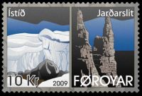
Depressions, Ice Ages and Erosion
The volcanoes on the Faroe Plateau became inactive millions of years ago.
 |
|
Depressions, Ice Ages and Erosion on stamp of the Faroe Islands 2009
MiNr.: 674, Scott: 513f.
|
Since then, external forces have eroded and shaped the formations
into the landscape we know today.
Subsidence of the land surface occurred due to the collapse and fracturing at the
base of the plateau imparting an easterly dip to the land surface.
Heat, frost, wind and water eroded the rock.
In valleys and fiords and sounds, which during the Ice Age still were above sea level,
mighty glaciers carved the rock on their way towards the sea and created a rugged
landscape.
Surf and strong currents took their share of the land.
Left in the middle of the North Atlantic Ocean, we find the archipelago known as
the Faroe Islands, a scarred monument of mighty forces of nature in the ancient past.
And the geological history of the Faroe Islands will probably not have a happy ending.
The erosion will continue and sometime in a distant future, the last cliff will plunge
into the sea and the billows dance over former glory.
Products and associated philatelic items
References:
Acknowledgement:
-
Many thanks to
Dr. Peter Voice from Department of Geological and Environmental Sciences, Western Michigan University, for reviewing the draft page .


